
Five of Five
Almost done. Let's end with an (unfair) quiz.

Okay, data nerds, what does this map tell us? About automobility, hint.
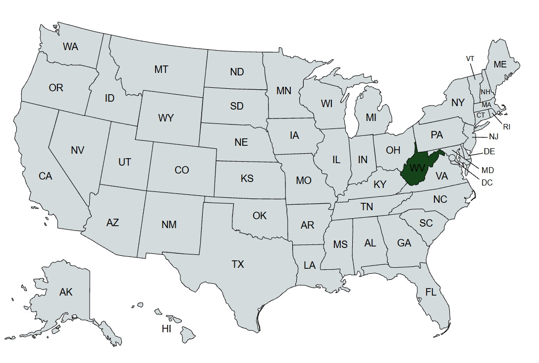
I won’t drag this out. “We find that about a quarter of urbanized land1 in America — roughly the size of West Virginia [ some 22,000 square miles ] — is dedicated to roadway. This land was worth around $4.1 trillion dollars in 2016.”
This is from Urban Roadway in America, by Guerra, Duranton, and Ma (2024). The authors used some very advanced data-munching techniques to pull this off, which I will not even attempt to describe: see the underlying paper2. They did not do this just for grins, but to help inform policy makers about the relative costs and benefits of roadways, into which I also will not go here: see the underlying paper.
But this blog is about nothing if not about how car culture is intertwined with the society and economy of America, and now we have another metric for that entwinement: our towns and cities have devoted 22,000 square miles to roads that enable cars and trucks and buses, etc., to get around.3 About the land area of West Virginia, with no disrespect intended to The Mountain State. And worth, by the authors’ calculations, over $4 trillion. That’s a lot of commitment to trucks and cars, by any measure, and for better or worse.
Those top-line facts are fascinating, but as is often the case, the details are even more intriguing, at least from my perspective. The paper includes extensive data on individual metropolitan areas. The 20 largest devote some 19% of their land area to roadways. But some stereotypes about different cities’ land use are challenged by the data: thus Boston, Phoenix, Seattle, and Washington DC (when have those four ever been grouped together?!?) are the leaders in roadway intensity (over 20%) while Los Angeles, which in the popular imagination is thought to consist of nothing but roadways (and some beaches) lags behind the average, at 17%. And good ol’ Sprawl Capital Houston brings up the rear (along with St. Louis) at 13%. Huh.
Okay, the NADA Show is done, and so am I. Car Charts will take a pause for a bit, but we will return with more automotive graphics which I hope you continue to find interesting, or if not interesting, at least amusing.
The study’s authors were not as interested in rural roads, and focused only on the 316 PMSAs (Primary Metropolitan Statistical Areas) which comprise about 80% of the American population and about 25% of the country’s land (excluding Alaska). I am not sure why rural roads were excluded, but I will guess this is because their marginal cost and impact on rural land use are relatively minimal, versus, e.g., the cost of the real estate under a street such as NYC’s Fifth Avenue. One can only imagine for what price the city could sell a block of such a street to a developer!
Let’s just quote Good Will Hunting: “My boy’s wicked smaht!”
Note that land devoted to parking spaces is not counted here - that’s for another discussion, as inspired by the late and very great Donald Shoup.